State Overview
(1) A state-level overview of where the migratory birds that breed in California are found during the non-breeding season based on Shared Stewardship Connection Maps.
(2) An overview of California's Focal Migratory Species. This includes:
- Conservation status
- Multi-species connection map that shows connections for focal species based on tagging data of individual birds
(3) Focal Species Accounts that provide detailed information on California's focal species. This includes:
- Conservation statistics and information about current Southern Wings projects
- Species Connection Maps that show connections across the annual cycle for each species based on tagging data of individual birds
- Conservation challenges
- Links to additional resources
(4) Partner organizations working in countries connected to California.
(5) Additional resources
Shared Stewardship Connections
These maps show where 38 migratory species that breed in California are concentrated during the nonbreeding season using year-round distribution models from eBird Status and Trends. They highlight opportunities for conservation across the full annual cycle of birds by informing locations for joint stewardship actions. Shared stewardship, on the left, represents the strength of connection between California and the nonbreeding distributions of California's migratory birds. Shared stewardship uniqueness, on the right, shows this information relative to all 50 states, emphasizing the hotspots where California has unique connections compared to other states. The values in each 3 x 3 km pixel combine information on the number of species, the nonbreeding abundances of those species, and the percent of each species’ breeding population in California.
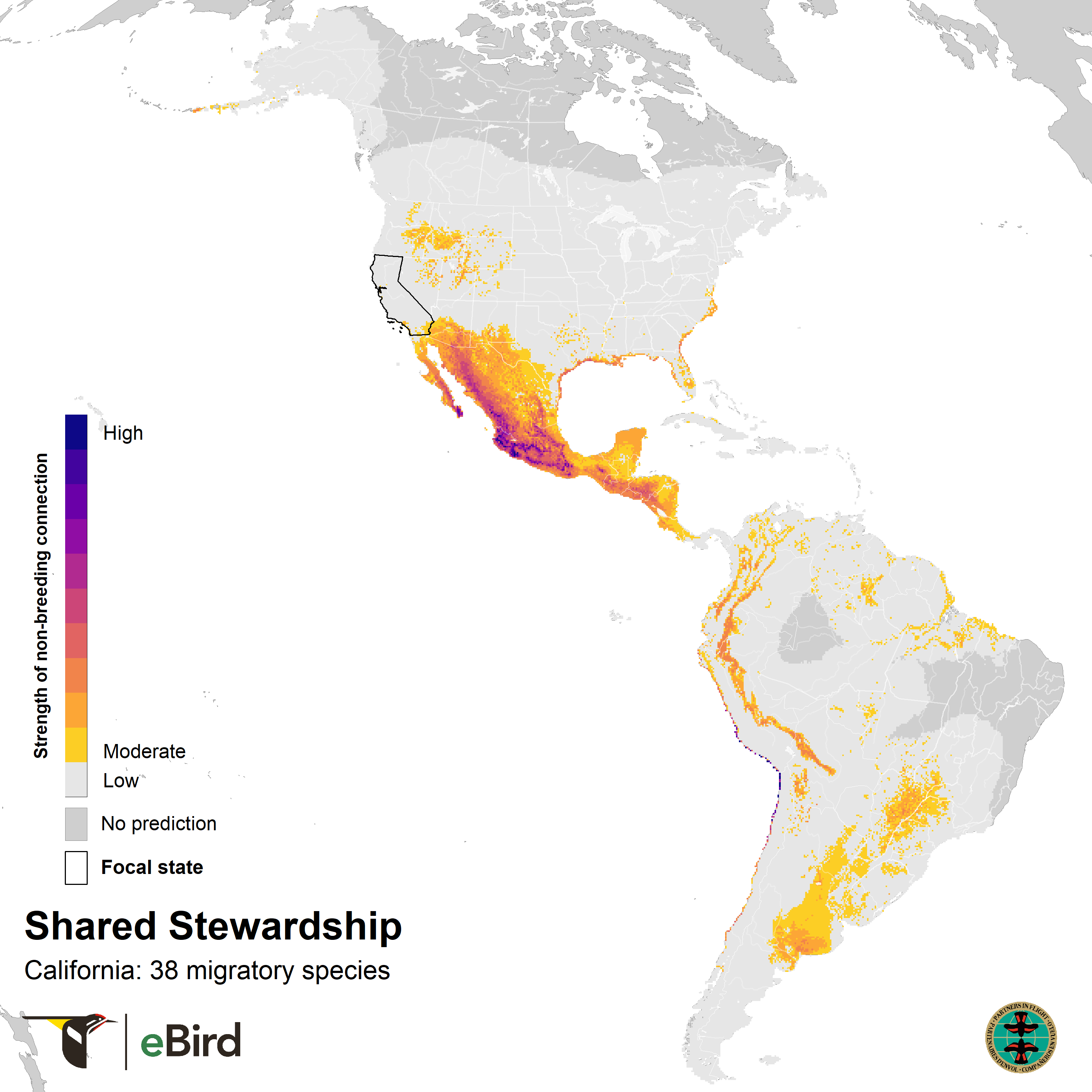
Shared stewardship connections highlight key areas where California's migratory species are concentrated during the nonbreeding season. Darker colors represent areas with stronger connections across all 38 species. Data source: Cornell Lab of Ornithology. Download map.
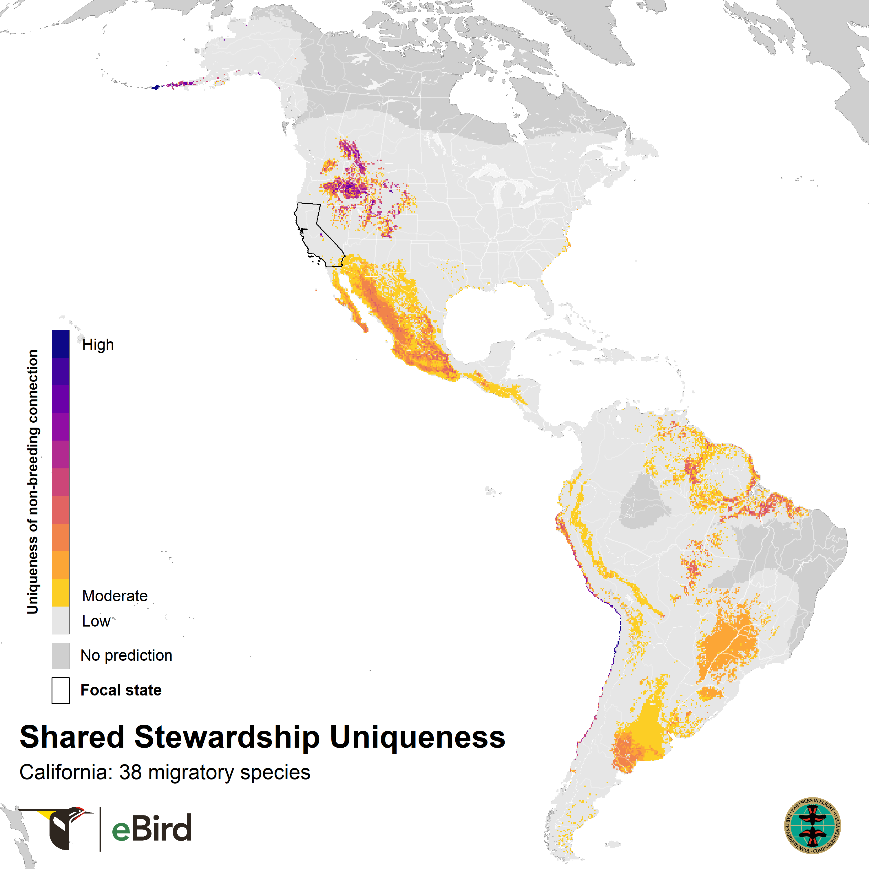
Uniqueness maps show where California has distinct shared stewardship connections compared to other U.S. states. Darker colors represent areas where California has a high proportion of stewardship connections relative to other states, highlighting unique opportunities to make a difference. Data source: Cornell Lab of Ornithology. Download map.
How were these maps created?
These maps used modeled information on the relative abundance and percent of population of bird species from eBird Status and Trends. Shared Stewardship maps are weighted sums of species’ nonbreeding populations at 3 x 3 km resolution, with the percentage of a species’ breeding population in California state as the weight. Thus, if a species has a higher percent breeding population in a state, its nonbreeding map will contribute more to that state’s shared stewardship. Shared stewardship uniqueness maps show these values relative to the total connections across all 50 U.S.A. states by calculating the proportion of the total connection strength attributed to California in each pixel. Download the complete list of species included in this map. For more information visit FAQs and eBird’s portal for state-level summaries.
Focal Migratory Species
We have compiled a list of 27 Neotropical migratory species that breed in California and have been identified as focal migratory species across multiple groups and initiatives. For more information about how this list was created, please see the section below "How was this table created?" By broadening the scope of this list beyond the Species of Greatest Conservation Need (SGCN), our intention was to create a resource that accounts for changes in SGCN associated with updated State Wildlife Action Plans (SWAPs) and provides a resource that has applications beyond updating SWAPs. We anticipate this list to update over time as SGCNs and other groups and initiatives revise their species lists.
How were these tables created?
We determined the list of focal migratory species for the state based on whether they satisfied any of the following criteria, specifically species were listed as:
- SGCN in the 2015 Wildlife Action Plan (source: USGS database), with more recent updates provided by some states;
- Regional SGCN (RSGCN; source: AFWA regional associations, MAFWA, NEAFWA, SEAFWA; we were not aware of any RSGCN list for WAFWA);
- Road to Recovery Tipping Point Species (R2R) that breed in the state;
- Neotropical migrants (source: USFWS Neotropical Migratory Bird Conservation Act species list and Partners in Flight Avian Conservation Assessment Database). We included partial migrants for states bordering Mexico or the Caribbean islands (CA, AZ, NM, TX, FL), or where requested by the state.
The complete table for download includes the following information for each species:
- SWAP: Whether it is listed in the state’s Wildlife Action Plan (yes or no),
- RSGCN: Whether and where it is a Regional SGCN (region or NA)
- BCC_status: Whether and where it is a USFWS 2021 Bird of Conservation Concern (region or NA)
- R2R_level: Whether it is a Road to Recovery Tipping Point Species and on which Alert List (Red, Orange or Yellow)
- pct_ brding_pop: The estimated percent of the species’ global population breeding in the state (source: eBird state-level data. Data are only shown for modeled species.
- Nb_biome: Non-breeding biome (source ACAD)
- Nb_hab_1: Broad non-breeding habitat class (source ACAD)
- Nb_hab_1: Descriptive non-breeding habitat class(source ACAD)
- Focal: Do we provide a focal species account (TRUE or FALSE)
| Tax. order | Common me | Sci. me | SGCN | BCC | R2R | % breeding pop. | Focal |
|---|---|---|---|---|---|---|---|
| 4803 | Allen's Hummingbird | Selasphorus sasin | no | Continental Concern | red | 99.5 | - |
| 33281 | Tricolored Blackbird | Agelaius tricolor | yes | Continental Concern | red | 98.42 | - |
| 27586 | Bendire's Thrasher | Toxostoma bendirei | yes | Continental Concern | red | 0.44 | - |
| 5900 | Mountain Plover | Arhynchus montanus | yes | Continental Concern | red | 0 | - |
| 5621 | Black Rail | Laterallus jamaicensis | yes | - | red | - | - |
| 6398 | Guadalupe Murrelet | Synthliboramphus hypoleucus | yes | Continental Concern | red | - | - |
| 6902 | Ashy Storm-Petrel | Hydrobates homochroa | yes | Continental Concern | red | - | - |
| 6485 | Western Gull | Larus occidentalis | no | Continental Concern | orange | 40.19 | - |
| 31563 | Evening Grosbeak | Coccothraustes vespertinus | no | Continental Concern | orange | 2.79 | - |
| 7218 | Pelagic Cormorant | Urile pelagicus | yes | - | orange | 1.24 | - |
| 6638 | Least Tern | Sternula antillarum | yes | Continental Concern | orange | 1.01 | yes |
| 3805 | Black Swift | Cypseloides niger | yes | Continental Concern | orange | 0.23 | yes |
| 6153 | Sanderling | Calidris alba | yes | - | orange | 0.08 | yes |
| 6130 | Red Knot | Calidris canutus | yes | Continental Concern | orange | 0.04 | yes |
| 6125 | Ruddy Turnstone | Areria interpres | yes | Regiol Concern | orange | 0.01 | yes |
| 5907 | Snowy Plover | Arhynchus nivosus | no | Continental Concern | yellow | 11.17 | - |
| 32468 | Black-chinned Sparrow | Spizella atrogularis | no | Continental Concern | yellow | 8.59 | - |
| 16581 | Olive-sided Flycatcher | Contopus cooperi | yes | Continental Concern | yellow | 4.76 | yes |
| 32678 | Sagebrush Sparrow | Artemisiospiza nevadensis | no | - | yellow | 1.85 | - |
| 6355 | Marbled Murrelet | Brachyramphus marmoratus | yes | Continental Concern | yellow | 0.21 | - |
| 5597 | Yellow Rail | Coturnicops noveboracensis | yes | Continental Concern | yellow | 0.01 | - |
| 6098 | Wandering Tattler | Tringa inca | yes | Continental Concern | yellow | 0 | - |
| 6830 | Short-tailed Albatross | Phoebastria albatrus | yes | - | yellow | - | - |
| 6718 | Elegant Tern | Thalasseus elegans | yes | Continental Concern | - | 24.69 | yes |
| 8308 | Swainson's Hawk | Buteo swainsoni | yes | - | - | 6.55 | yes |
| 7288 | American White Pelican | Pelecanus erythrorhynchos | yes | Regiol Concern | - | 4.1 | yes |
| 33453 | Lucy's Warbler | Leiothlypis luciae | yes | - | - | 1.62 | yes |
For each species, we include the following information in the table:
-
SGCN: Whether it is listed in California's 2015 Wildlife Action Plan (yes or no).
-
BCC: Whether and where it is a Regional SGCN (region or blank).
-
R2R: Whether it is a Road to Recovery Tipping Point Species and on which Alert List (Red, Orange or Yellow).
-
% breeding pop: The estimated percent of the species’ global population breeding in California (source: eBird state-level data). Data are only shown for modeled species.
-
Focal Account: Do we provide a focal species account (yes or no).
Download full table.
For additional conservation statistics for each species, please visit the Comprehensive Table of State Birds on e-Bird's portal and download the species-level summaries.
Multi-species Connections
This map shows direct connections between California and other locations across the Western Hemisphere based on tagging data available in the Bird Migration Explorer for the state’s migratory focal species. Connections are based on bird band encounter records, automated radio telemetry, archival geolocators, satellite and GPS tracking, or genetic markers that document the movement of individual birds. The map displays the number of migratory focal species that connect each location (hexagon) to California. While these data offer valuable insight, they do not capture the complete picture of all connections because they only present available tagging data for the subset of species of concern identified by each state. The multi-species tagging connections map illustrates the need to protect, restore, enhance and manage safe habitat in locations connected to the state to ensure migratory species can access the resources they need across the full annual cycle. As individual birds travel between species’ summer (breeding) and winter (stationary non-breeding) ranges, they traverse geopolitical boundaries, underscoring the need for coordinated conservation efforts to maximize the return on conservation investments in California. Additionally, multi-species connection maps illustrate California's crucial role in safeguarding the migratory movements of these species.

This map shows direct connections between California and locations across the hemisphere based on available tagging data for the state’s migratory focal species. Data were generously shared by researchers and partners for the Bird Migration Explorer. The map displays the number of tagged focal species that connect locations to California. Download map.
How was this map created?
The multi-species connections maps are based on millions of observations generously shared by a variety of data holders and partner organizations. Key sources of data for tagging birds include: band encounter records from the USGS Eastern Ecological Science Center Bird Banding Lab, automated radio telemetry from the Motus global wildlife tracking network developed and managed by Birds Canada, location data from hundreds of tracked birds shared by our partners and the research community on Movebank, and genetic connectivity data shared by the Bird Genoscape Project. The original data are archived by each of these partners. The tagging data are summarized across the entire timespan inclusive of these datasets (1914-2023) for the state's set of focal species.
Bird movements were aggregated and summarized into 150-km hexagons covering the Americas. We pre-processed data to remove points with high locational error (i.e., outliers), such as points collected during the equinox period for light-level geolocator data and incomplete or questionable banding and automated radio telemetry records.
For each species, the remaining points were intersected with the 150-km hexagon grid. We considered hexagons to be connected so long as the same individual occurred in both of them, whether those occurrences were within the same year or across multiple years. We filtered the linked hexagon pairs to just those with hexagons intersecting the state. The final multi-species connections map displays the number of focal species that connect each location to the state.
Focal Migratory Species Accounts
For a selection of focal migratory species relevant to California, we provide an account with detailed information about their conservation status, a Species-specific Connections Map illustrating its hemispheric connections across the annual cycle, and a list of the conservation challenges (human activities and environmental changes) faced across the year, current Southern Wings projects and links to additional resources about each species.
Species accounts were selected in consultation with state agency staff based on the Focal Migratory Species List. In brief, species were selected from the Focal Migratory Species List by extracting all SGCN based on 2015 SWAPs and prioritizing species based on: (1) the percentage of the breeding populations in California; (2) each species’ Road to Recovery level; and (3) input from state agency staff. We expect the list of species accounts to change over time as state’s release updated SWAPs and SGCN.
Species Connections Maps
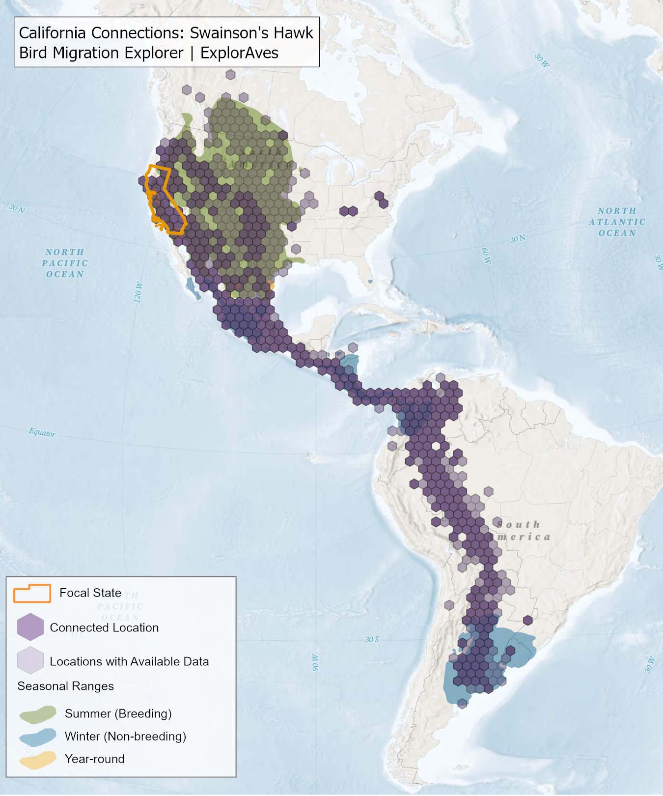
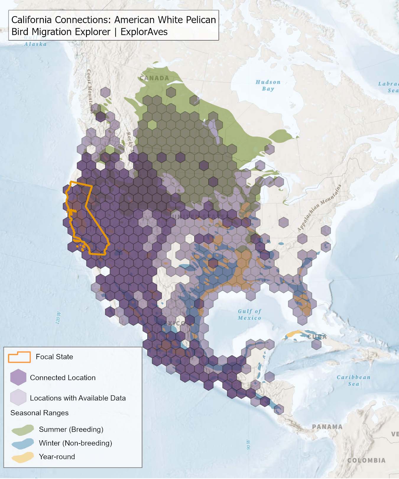
The species connection maps show direct connections between California and locations across the Western Hemisphere based on tagging data in the Bird Migration Explorer available for each of the state’s migratory species of concern. Connections are based on bird band encounter records, automated radio telemetry, archival geolocators, satellite and GPS tracking, or genetic markers that document the movement of individual birds. The maps display locations (i.e., hexagons) that are connected to California (polygon outlined orange) and illustrate the need to protect, restore, enhance and manage safe habitat in those areas to ensure species can satisfy their biological requirements across the full annual cycle. As individual birds travel between the species’ summer (breeding) and winter (stationary non-breeding) ranges, they traverse geopolitical boundaries, underscoring the need for collaborative and coordinated conservation efforts to maximize the return on conservation investments for the species in California. While these maps offer valuable insight, they do not capture the complete picture of all connections, because they only present tagging data available in the Bird Migration Explorer. In some cases, species may not have a connection map, because no tagging data are available.
How were the species connections maps created?
The species connections maps are based on millions of observations generously shared by a variety of data holders and partner organizations. Key sources of data for tagged birds include: band encounter records from the USGS Bird Banding Lab, automated radio telemetry from the Motus global wildlife tracking network developed and managed by Birds Canada, location data from hundreds of tracked birds shared by our partners and the research community on Movebank, and genetic connectivity data shared by the Bird Genoscape Project. Seasonal ranges are derived from eBird at the Cornell Lab and data from BirdLife International and Audubon. The original data are archived by each of these partners. The tagging data are summarized across all datasets (including years 1914-2023) for the species.
Bird movements were aggregated and summarized into 150-km hexagons covering the Americas. We pre-processed data to remove points with high locational error (i.e., outliers), such as points collected during the equinox period for light-level geolocator data and incomplete or questionable banding and automated radio telemetry records.
For each species, the remaining points were intersected with a 150-km hexagon grid. We considered hexagons to be connected so long as the same individual occurred in both of them, whether those occurrences were within the same year or across multiple years. We filtered the linked hexagon pairs to just those with hexagons intersecting the state.
The final species connections maps display the hexagons that are connected to the state (dark purple) as well as hexagons with available tagging data for the species (light purple) with no direct connections to the state.
Conservation Challenges
Conservation Challenges are human activities and environmental changes that a species is sensitive to during its annual cycle. Threats are defined as human activities and environmental changes that negatively impact a migratory bird species (Salafsky et al. 2008); however, many human activities that present threats to birds can also present a component of the solution. The term “conservation challenge” conveys both the risk and opportunity associated with each of these activities.
The list of conservation challenges provided for each species is derived from the conservation challenges that are included in the Bird Migration Explorer, which are those conservation challenges that are accurately and consistently mapped across the Western Hemisphere.
How were conservation challenges identified for each species?
We used the list of 19 conservation challenges that were included in the Bird Migration Explorer. The “About the Bird Migration Explorer Conservation Challenges” provides a detailed description of how the 19 challenges were selected for inclusion in the Explorer.
The Bird Migration Explorer used the conservation lexicon developed by Salafsky et al. (2008) and subsequently used in multiple conservation planning frameworks to identify the conservation challenges relevant for each migratory species. In this framework, threats are defined as human activities that negatively impact bird species (Salafsky et al. 2008). Sensitivity is the extent to which stresses linked to threat exposure negatively impact a species. Based on a combination of literature review and expert knowledge within this framework, 88 threats relevant to migratory birds were developed. Stresses are the attributes of a species’ ecology that are impaired by threats (Salafsky et al. 2008). The Explorer used a list of seven stresses adapted from the list used by IUCN (International Union for Conservation of Nature 2012). Next, to identify a subset of threats that each species was sensitive to, a literature review was conducted to determine which threats have a negative impact on a species and the stresses that the threat causes to it. In cases where there was no information on a species sensitivity to a threat, but sensitivity to the threat was documented for a similar related species (e.g., same genus, or similar life history characteristics), both species were considered to be sensitive to it.
Next, threats were pooled into conservation challenges (e.g., agricultural pesticide/herbicide application and agricultural development threats were merged into the conservation challenge of agriculture). The list of conservation challenges was narrowed to those that could be accurately and consistently mapped across the Western Hemisphere, which resulted in 19 conservation challenges that were included in the Bird Migration Explorer. Because some conservation challenges, like invasive and problematic species (e.g., outdoor cats) do not have available hemispheric maps, the list of conservation challenges is not comprehensive. The list of conservation challenges on the Bird Migration Explorer and included in this online guide include:
- Urban Areas
- Surburban Areas
- Coastal Modification
- Agriculture
- Livestock Management
- Oil and Gas Production
- Wind Turbines
- Roads
- Power Lines
- Communication Towers
- Forest Management
- Coastal Disturbance
- Groundwater Depletion
- Surface Water Management
- Light Pollution
- Water Quality
- Sea Level Rise
- Increasingly Severe Flooding
- Drought
Literature cited
Salafsky N et al. 2008. A standard lexicon for biodiversity conservation: Unified classifications of threats and actions. Conservation Biology 22:897–911.
Scroll down the list of species and click on any particular one to expand its account.
Least Tern (Sternula antillarum)
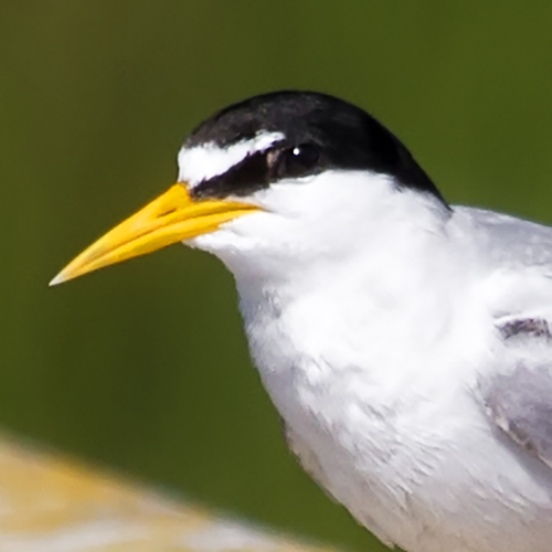
Status: ⚠ Not an SGCN in California
Regional SGCN: Southeast
R2R Level: Orange
Percent of population breeding in state: 2.06%
Nonbreeding biome and habitat: Neotropical (Coasts: Beach and Estuary)
Photo Credit: Sandy/Chuck Harris via Flickr, CC BY-NC 2.0
No tracking data available from the Bird Migration Explorer’s partners for this species in the state.
Conservation Challenges
Below is a list of conservation challenges faced by Least Tern across the full annual cycle, including:
- urban areas
- suburban areas
- power lines
- communication towers
- coastal disturbance
- surface water management
- groundwater depletion
- coastal modification
- light pollution
- sea level rise
- increasingly frequent flooding
For maps of threats facing this species, see the Bird Migration Explorer.
More resources on this species:
- All About Birds
- Birds of the World (subscription needed)
- eBird Status and Trends
- Bird Migration Explorer
Black Swift (Cypseloides niger)
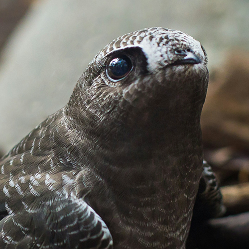
Status: NA SGCN in California
Regional SGCN: No
R2R Level: Orange
Percent of population breeding in state: 0.23%
Nonbreeding biome and habitat: South American Lowlands (Forest Aerial: Tropical Generalist)
Photo Credit: Spring Fed Images via Unsplash, Unsplash License
No tracking data available from the Bird Migration Explorer’s partners for this species in the state.
Conservation Challenges
Below is a list of conservation challenges faced by Black Swift across the full annual cycle, including:
- urban areas
- suburban areas
- forest management
- surface water management
- coastal modification
- increasingly frequent flooding
For maps of threats facing this species, see the Bird Migration Explorer.
Southern Wings project:
More resources on this species:
- All About Birds
- Birds of the World (subscription needed)
- eBird Status and Trends
- Bird Migration Explorer
Sanderling (Calidris alba)
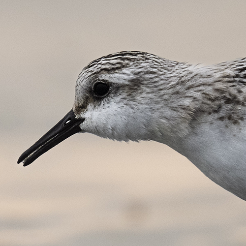
Status: NA SGCN in California
Regional SGCN: No
R2R Level: Orange
Percent of population breeding in state: 0.08%
Nonbreeding biome and habitat: Widespread (Coasts: Beach and Estuary)
Photo Credit: Florian Dehn via Flickr, CC0 1.0
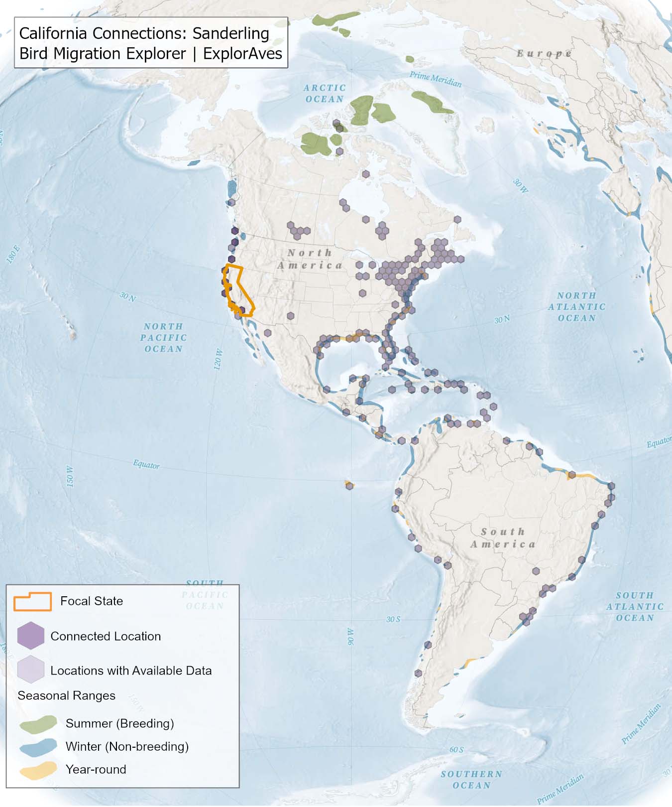
Species connections map:
This map shows direct connections between California and locations across the hemisphere based on available tagging data for individual Sanderling shared by researchers for the Bird Migration Explorer. Data were generously shared by researchers for the Bird Migration Explorer. The map displays the hexagons that are connected to the state (dark purple) as well as hexagons with available tagging data for the species (light purple) with no direct connections to the state. Explore more connections for Red Knot on the Bird Migration Explorer. Download map.
Conservation Challenges
Below is a list of conservation challenges faced by Sanderling across the full annual cycle, including:
- urban areas
- suburban areas
- agriculture
- livestock management
- oil and gas production
- wind turbines
- communication towers
- coastal disturbance
- surface water management
- groundwater depletion
- coastal modification
- water quality
- light pollution
- sea level rise
For maps of threats facing this species, see the Bird Migration Explorer.
Southern Wings projects:
More resources on this species:
- All About Birds
- Birds of the World (subscription needed)
- eBird Status and Trends
- Bird Migration Explorer
Red Knot (Calidris canutus)
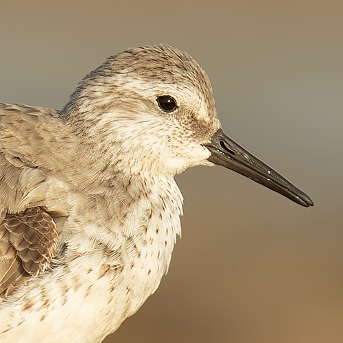
Status: NA SGCN in California
Regional SGCN: No
R2R Level: Orange
Percent of population breeding in state: 0.04%
Nonbreeding biome and habitat: Widespread (Coasts: Beach and Estuary)
Photo Credit: JJ Harrison via Wikimedia Commons, CC BY-SA 2.0
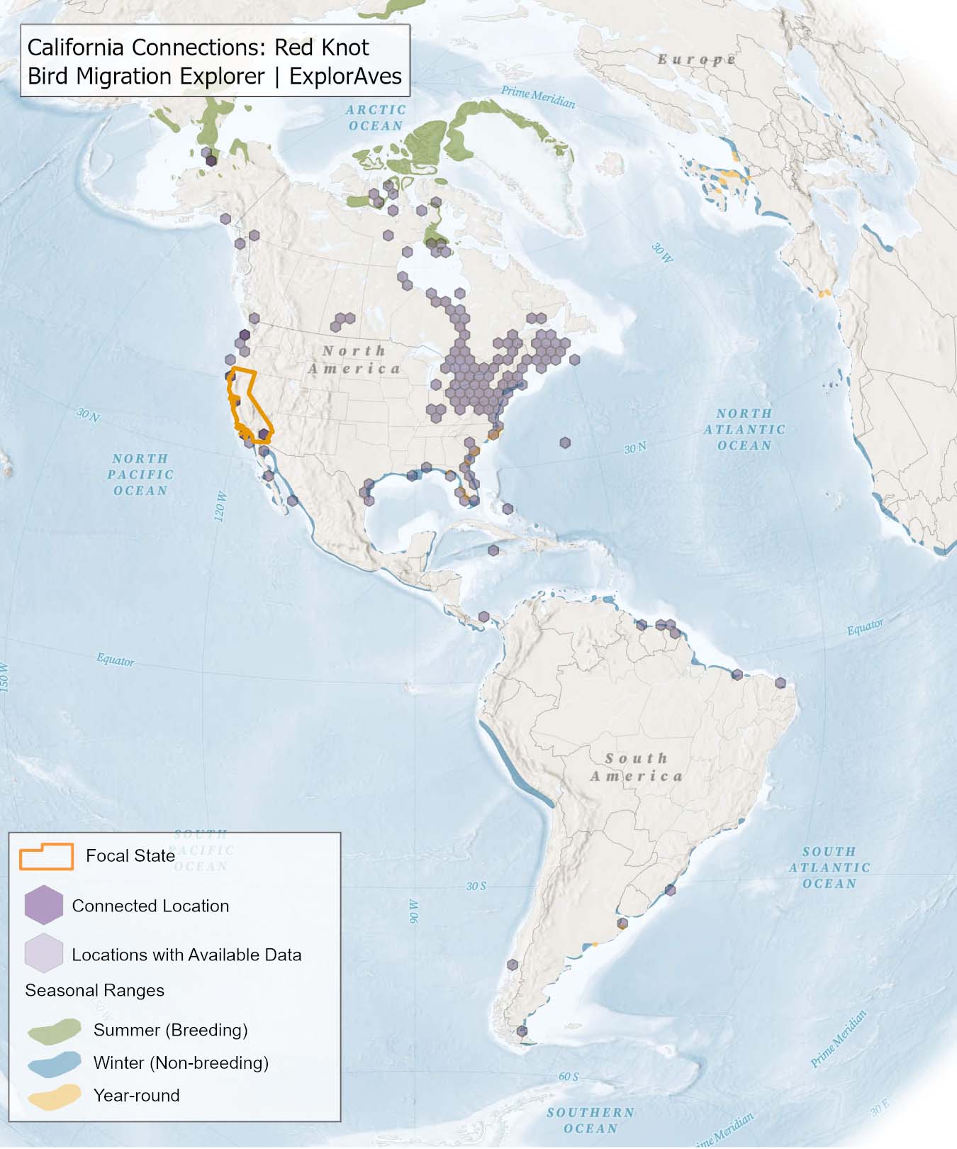
Species connections map:
This map shows direct connections between California and locations across the hemisphere based on available tagging data for individual Red Knot shared by researchers for the Bird Migration Explorer. Data were generously shared by researchers for the Bird Migration Explorer. The map displays the hexagons that are connected to the state (dark purple) as well as hexagons with available tagging data for the species (light purple) with no direct connections to the state. Explore more connections for Red Knot on the Bird Migration Explorer. Download map.
Conservation Challenges
Below is a list of conservation challenges faced by Red Knot across the full annual cycle, including:
- urban areas
- suburban areas
- oil and gas production
- wind turbines
- power lines
- communication towers
- coastal disturbance
- surface water management
- groundwater depletion
- coastal modification
- water quality
- light pollution
- drought
- sea level rise
For maps of threats facing this species, see the Bird Migration Explorer.
Southern Wings projects:
More resources on this species:
- All About Birds
- Birds of the World (subscription needed)
- eBird Status and Trends
- Bird Migration Explorer
Ruddy Turnstone (Arenaria interpres)
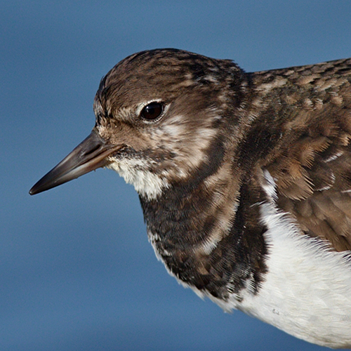
Status: NA SGCN in California
Regional SGCN: No
R2R Level: Orange
Percent of population breeding in state: 0.01%
Nonbreeding biome and habitat: Widespread (Coasts: Beach and Estuary; Coasts: Rocky Intertidal)
Photo Credit: Andrej Chudý via Flickr, CC BY-NC-SA 2.0
No tracking data available from the Bird Migration Explorer’s partners for this species in the state.
Conservation Challenges
Below is a list of conservation challenges faced by Ruddy Turnstone across the full annual cycle, including:
- urban areas
- suburban areas
- wind turbines
- power lines
- communication towers
- coastal disturbance
- coastal modification
- water quality
- light pollution
- sea level rise
- increasingly frequent flooding
For maps of threats facing this species, see the Bird Migration Explorer.
More resources on this species:
- All About Birds
- Birds of the World (subscription needed)
- eBird Status and Trends
- Bird Migration Explorer
Olive-sided Flycatcher (Contopus cooperi)
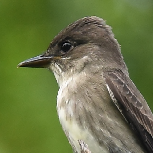
Status: NA SGCN in California
Regional SGCN: No
R2R Level: Yellow
Percent of population breeding in state: 4.76%
Nonbreeding biome and habitat: Central and South American Highlands (Forests: Tropical Montane Evergreen; Forests: Tropical Lowland Evergreen)
Photo Credit: Andy Reago & Chrissy McClarren via Flickr, CC BY 2.0
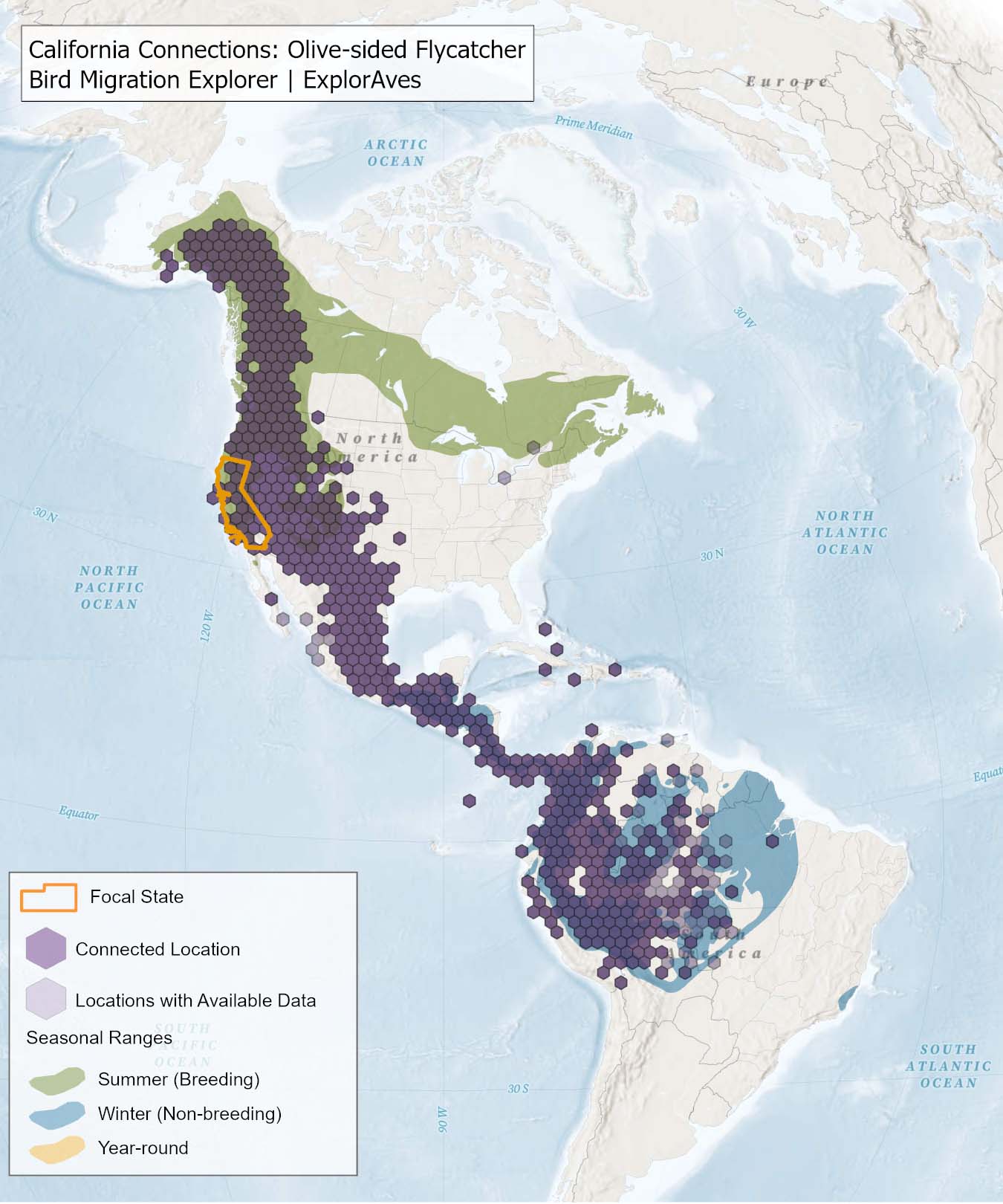
Species connections map:
This map shows direct connections between California and locations across the hemisphere based on available tagging data for individual Olive-sided Flycatcher shared by researchers for the Bird Migration Explorer. Data were generously shared by researchers for the Bird Migration Explorer. The map displays the hexagons that are connected to the state (dark purple) as well as hexagons with available tagging data for the species (light purple) with no direct connections to the state. Explore more connections for Olive-sided Flycatcher on the Bird Migration Explorer. Download map.
Conservation Challenges
Below is a list of conservation challenges faced by Olive-sided Flycatcher across the full annual cycle, including:
- urban areas
- suburban areas
- agriculture
- livestock management
- power lines
- communication towers
- forest management
- light pollution
For maps of threats facing this species, see the Bird Migration Explorer.
Southern Wings projects:
More resources on this species:
- All About Birds
- Birds of the World (subscription needed)
- eBird Status and Trends
- Bird Migration Explorer
Elegant Tern (Thalasseus elegans)
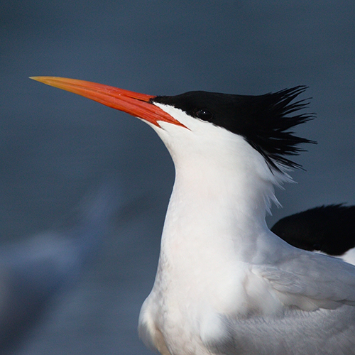
Status: NA SGCN in California
Regional SGCN: No
R2R Level: None
Percent of population breeding in state: 24.69%
Nonbreeding biome and habitat: Pacific North America (Coasts: Beach and Estuary; Coasts: Marine Waters)
Photo Credit: Andrej Chudý via Flickr, CC BY-NC-SA 2.0
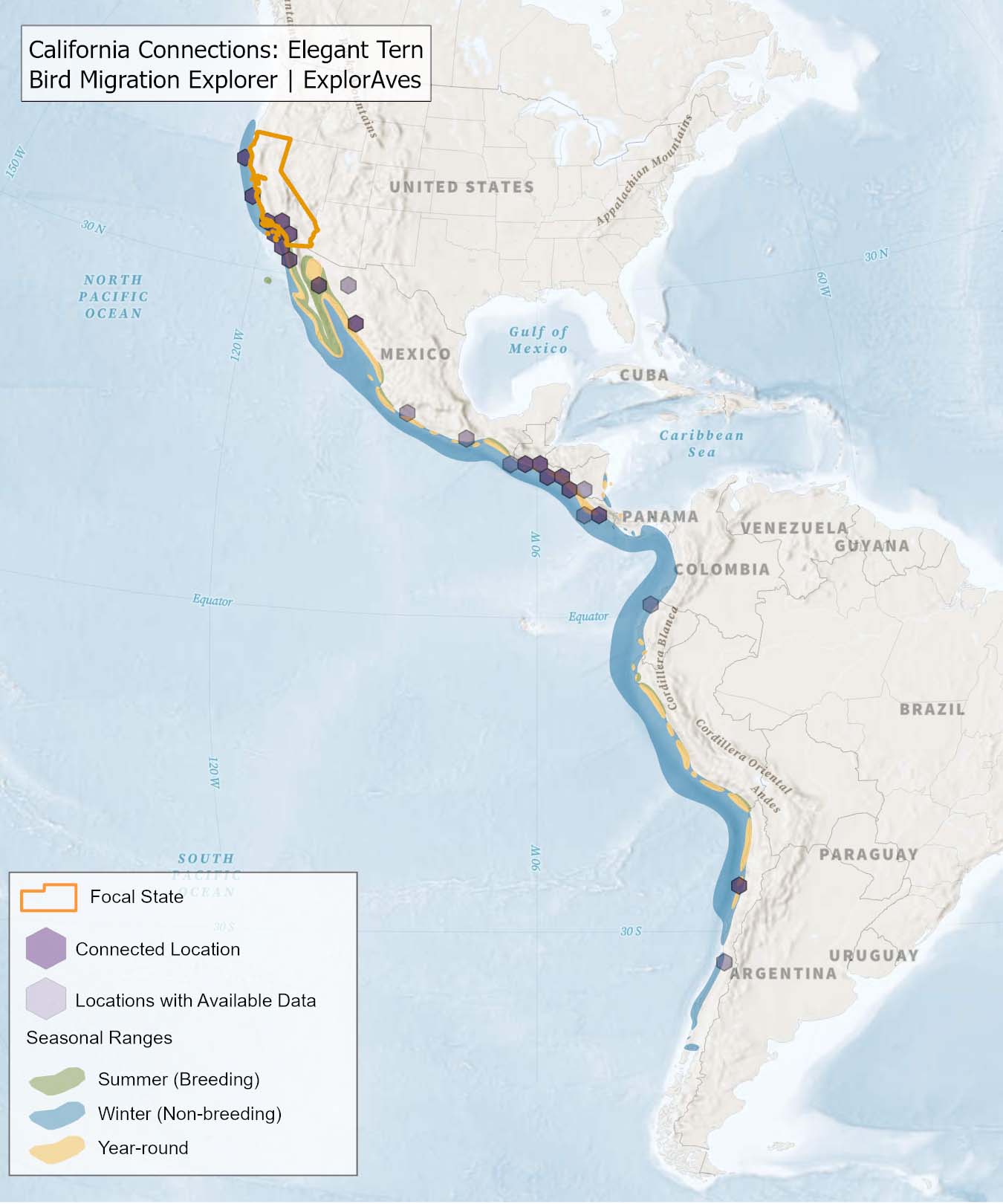
Species connections map:
This map shows direct connections between California and locations across the hemisphere based on available tagging data for individual Elegant Tern shared by researchers for the Bird Migration Explorer. Data were generously shared by researchers for the Bird Migration Explorer. The map displays the hexagons that are connected to the state (dark purple) as well as hexagons with available tagging data for the species (light purple) with no direct connections to the state. Explore more connections for Elegant Tern on the Bird Migration Explorer. Download map.
Conservation Challenges
Below is a list of conservation challenges faced by Elegant Tern across the full annual cycle, including:
- urban areas
- suburban areas
- power lines
- communication towers
- water quality
- light pollution
- sea level rise
For maps of threats facing this species, see the Bird Migration Explorer.
More resources on this species:
- All About Birds
- Birds of the World (subscription needed)
- eBird Status and Trends
- Bird Migration Explorer
Swainson’s Hawk (Buteo swainsoni)
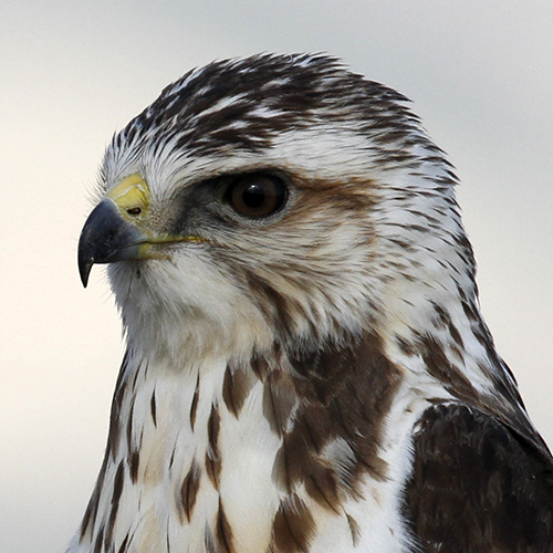
Status: NA SGCN in California
Regional SGCN: No
R2R Level: None
Percent of population breeding in state: 6.55%
Nonbreeding biome and habitat: Temperate South America (Grasslands: Pampas and Campos)
Photo Credit: Robin Gwen Agarwal via Flickr, CC BY-NC 2.0
Species connections map:
This map shows direct connections between California and locations across the hemisphere based on available tagging data for individual Swainson's Hawk shared by researchers for the Bird Migration Explorer. Data were generously shared by researchers for the Bird Migration Explorer. The map displays the hexagons that are connected to the state (dark purple) as well as hexagons with available tagging data for the species (light purple) with no direct connections to the state. Explore more connections for Swainson's Hawk on the Bird Migration Explorer. Download map.
Conservation Challenges
Below is a list of conservation challenges faced by Swainson's Hawk across the full annual cycle, including:
- urban areas
- suburban areas
- agriculture
- oil and gas production
- wind turbines
- roads
- power lines
- coastal modification
For maps of threats facing this species, see the Bird Migration Explorer.
Southern Wings projects:
More resources on this species:
- All About Birds
- Birds of the World (subscription needed)
- eBird Status and Trends
- Bird Migration Explorer
American White Pelican (Pelecanus erythrorhynchos)
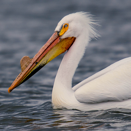
Status: NA SGCN in California
Regional SGCN: No
R2R Level: None
Percent of population breeding in state: 4.1%
Nonbreeding biome and habitat: Widespread (Coasts: Saltmarsh; Wetlands: Lakes and Rivers)
Photo Credit: TexasEagle via Flickr, CC BY-NC 2.0
Species connections map:
This map shows direct connections between California and locations across the hemisphere based on available tagging data for individual American White Pelican shared by researchers for the Bird Migration Explorer. Data were generously shared by researchers for the Bird Migration Explorer. The map displays the hexagons that are connected to the state (dark purple) as well as hexagons with available tagging data for the species (light purple) with no direct connections to the state. Explore more connections for American White Pelican on the Bird Migration Explorer. Download map.
Conservation Challenges
Below is a list of conservation challenges faced by American White Pelican across the full annual cycle, including:
- agriculture
- wind turbines
- power lines
- surface water management
- groundwater depletion
- water quality
- drought
- sea level rise
- increasingly frequent flooding
For maps of threats facing this species, see the Bird Migration Explorer.
More resources on this species:
- All About Birds
- Birds of the World (subscription needed)
- eBird Status and Trends
- Bird Migration Explorer
Lucy’s Warbler (Leiothlypis luciae)
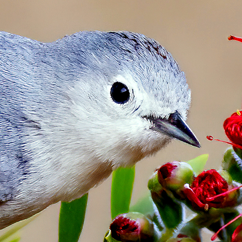
Status: NA SGCN in California
Regional SGCN: No
R2R Level: None
Percent of population breeding in state: 1.62%
Nonbreeding biome and habitat: Mesoamerican Pacific Lowlands (Forests: Tropical Dry; Aridlands: Desert Riparian)
Photo Credit: Mick Thompson via Flickr, CC BY-NC 2.0
No tracking data available from the Bird Migration Explorer’s partners for this species in the state.
Conservation Challenges
Below is a list of conservation challenges faced by Lucy's Warbler across the full annual cycle, including:
- urban areas
- suburban areas
- agriculture
- livestock management
- wind turbines
- roads
- communication towers
- forest management
- surface water management
- groundwater depletion
- light pollution
- drought
For maps of threats facing this species, see the Bird Migration Explorer.
More resources on this species:
- All About Birds
- Birds of the World (subscription needed)
- eBird Status and Trends
- Bird Migration Explorer


